
Explore on foot
Walks & Hikes
From a lakeside stroll to an alpine summit, Queenstown's tracks are some of the most beautiful in the world — and most start within minutes of town.
A hand-picked range — flat lakeside paths, half-day hill climbs, and a true alpine summit — plus one of the country's Great Walks nearby. Check the difficulty and current conditions, then pick your day.
The tracks
Tiki Trail
Bob's Peak / Skyline — in town
~2 km one way · 45–60 min · 400 m climb
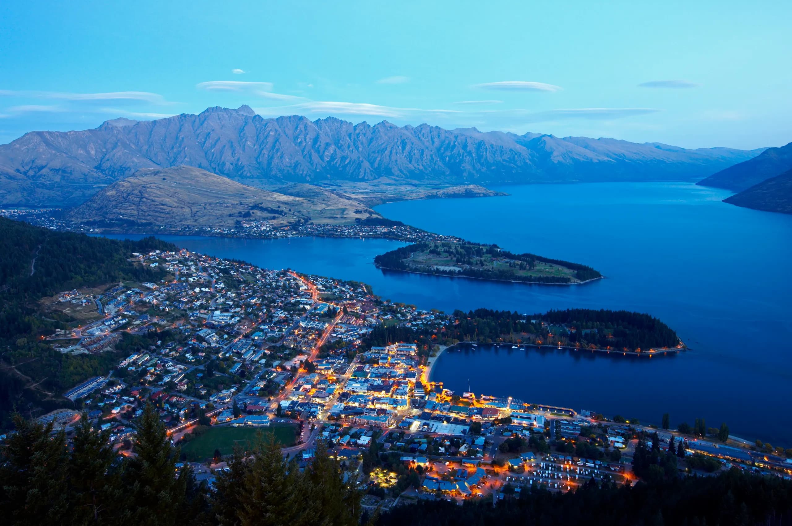
Zig-zags up through Douglas-fir forest to the Skyline viewpoint over Queenstown and the Remarkables. Walk up, gondola down — or keep climbing to Ben Lomond.
Trailhead map ↗Queenstown Hill (Time Walk)
Belfast Terrace — in town
~4.8 km return · 2–2.5 hr · 400 m climb
A steady zig-zag climb to the 'Basket of Dreams' sculpture and a full panorama over the Wakatipu basin. Straight from the edge of town.
Trailhead map ↗Ben Lomond Track
via Tiki Trail / gondola
~11–14 km return · 6–8 hr · summit 1,748 m
Queenstown's classic alpine summit — tussock, a high saddle and a 360° top. A big, weather-dependent day: start early, carry layers, and turn back if the cloud comes in.
Trailhead map ↗Moke Lake Loop
Moke Lake — 20 min
~6.5 km loop · ~2 hr · flat
A near-level circuit of a mirror-calm lake ringed by tussock peaks. Camping, swimming and kayaking in summer — and one of the best sunrise spots in the district.
Trailhead map ↗Frankton Track
Frankton Arm lakeside
~7 km one way · ~2 hr · flat
A flat, easy lakeside path from town along the Frankton Arm — walk, run or push a buggy, with constant water and mountain views the whole way.
Trailhead map ↗Bob's Cove Track
Glenorchy Road — 15 min
~3 km loop · ~1 hr · easy
A short beech-forest loop down to a turquoise cove and the historic 1880s lime kilns. Family-friendly, with a short optional climb to a lookout.
Trailhead map ↗Sawpit Gully Loop
Arrowtown — 20 min
~7 km loop · 2.5–3 hr
A loop above historic Arrowtown through gullies and the old Chinese settlement, with big valley views. Spectacular when the autumn colours turn.
Trailhead map ↗Routeburn Track (day walk)
Glenorchy — 45 min to trailhead
Great Walk · day option or 2–3 days
One of New Zealand's Great Walks, right on the doorstep. Day-walk to the Routeburn Flats or Falls, or do the full alpine crossing — huts must be booked through DOC.
Trailhead map ↗Before you go — maps & safety
Mountain weather changes fast. Grab a proper track map, check the forecast and any alerts, carry layers and water, and tell someone your plans. Alpine tracks (Ben Lomond, the Routeburn) demand real gear and an early start.
Walking & trail events
The Lord of the Rings Marathon Experience
Marathon through Middle-earth filming locations.
Motatapu
The Motatapu is a bucket list trail running and mountain bike event with the following awesome events offering challenging yet achievable courses:
Walking guides
All guides →
Queenstown in Spring: Skiing, Blossom and the Quiet Weeks
Spring starts here while the fields are still turning. Ski in the morning, ride a dry valley trail in the afternoon, and get the place between two peaks.
Queenstown Walks and Hikes: Ten Tracks from 40 Minutes to All Day
From a flat lap of the Gardens to the long grind up Ben Lomond. Ten walks around Queenstown with honest times, real gradients, and which ones are worth the effort.